Services
The Corporation has two main geophysical services:
- Remote survey of territories, deposits and drilling points – Geodirect RSS.
- Ground survey of various objects, deposits, drilling points, carried out during the expedition to the area – Geodirect NMR.
Both services, remote and ground, refer to direct geophysical methods, when deposits of minerals are directly identified, delineated and explored. Interpretation of indirect data is not needed and is not performed.
The physical basis for both methods are resonance effects.

Remote survey is the Resonant Spectral Sounding (RSS) of the Earth using satellite images of the area.
For ground research, the method of Nuclear Magnetic Resonance (NMR) is used.

Both methods are unique in their capabilities and effectiveness:

The main service for solving a wide range of geophysical problems, due to its versatility, efficiency and relative cheapness, is the Geodirect RSS service.
Geodirect RSS service for regional survey of territories
The standard approach to surveying the territory of the Customer is to first “diagnose” the site in a regional survey format, and then, if the required deposits are available, to conduct their detailed survey.
This approach can significantly reduce the time and financial costs of the Customer in case of identifying “empty” sites.
How the RSS service works for direct remote survey of territories

During a regional survey of the Customer’s territory, the Geodirect RSS service provides:
Survey areas may be from one sq.km up to tens of thousands of square kilometers.
Examination duration lies within 1 – 2 months.
As a result of the survey we get the following data:
– ground contours of identified deposits,
– isolines of response levels of signals,
– contours of fault zones,
– zones and points of maximum signal responses.
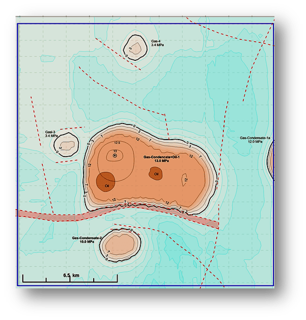
At the request of the Customer, the list of data obtained at this stage can be expanded.
Geodirect RSS service for detailed survey of deposits
During a detailed remote survey of the identified deposits, the Customer receives the following data (example for hydrocarbons):
Survey Areas may range from one to hundreds square km.
Examination duration lies within 1 – 2 months.
As a result of the survey we get the following data:
– updated ground contours of deposits and fault zones,
– zones and perspective points for drilling wells,
– the number of horizons, their thickness and depth,
– the presence of gas caps and pressure in them,
– watering horizons;
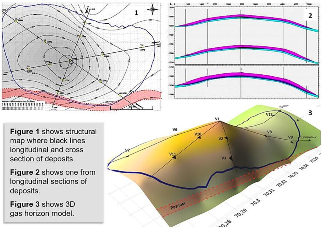
– transverse and longitudinal sections of deposits,
– 3D model;
– predicted resources of the deposit.
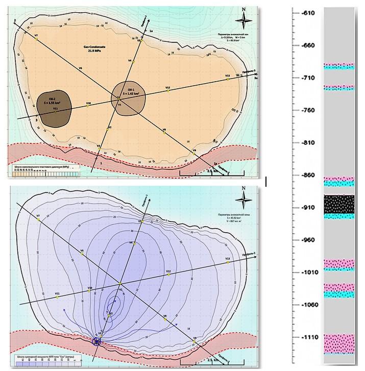
As well as structural diagrams, deep sections of the deposit, 3D model of the horizon roof:
Survey results for the Customer

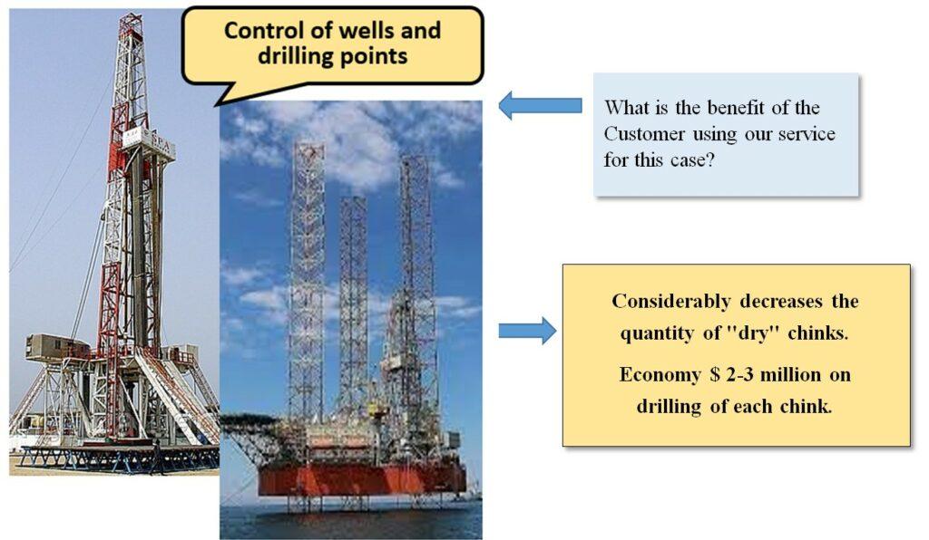
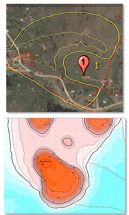
Geodirect RSS service for detailed survey of drilling sites
When remotely surveying locations for drilling, the Customer receives the following data (example for hydrocarbons):
Surveying areas are several km2.
Duration surveys lies within one month.
As a result of the survey we get the following data:
– presence or absence hydrocarbons at a point control,
– ground contours of the reservoir,
– zones and points of maximum signal responses,
– the number of horizons in drilling point, their power, depth of occurrence,
– the presence of gas caps and pressure in them,
– contours of the nearest deposits in case of a “dry“ drilling point.
Survey results for the Customer